Friday, December 12, 2014

The MAC - Purple Loop Trail


The MAC from the Purple Trail.  The Challenge Trail climbs to the top of the ridge
Today's hike was along the Purple Loop Trail at the MAC in Castle Rock.
This natural surface trail climbs quickly and provides views of Castle Rock and the new MAC site. This is the shortest of the 5 hiking/bicycling trails and it is interconnected to the Gold Loop Trail, the Red Loop Trail and the Green Loop Trail, all of which add up to over 8 miles of hilly hiking or bicycling.  This trail starts to the north of the site and is across the street from the Challenge Hill, a 200-step staircase similar in design to the Manitou Springs Incline. Challenge Hill also has the Blue Loop Trail which climbs to the top, in case you need a break from the steps.
The community park site includes a zip-line course and an adventure playground area.  The MAC is a world-class fitness facility with indoor and outdoor lighted synthetic surface fields, activity classes, a pool, classes of workout routines, a golf simulator and a trampoline.
Awesome new trail construction
Trail construction is recent and is done well with water bars and a downhill slanted trail bed for drainage.  Some sections are steep, so you need to watch your step and not slip-slide away.  A couple in front of us slipped into a trail side cactus on the loose gravel, so do be careful.
Mostly scrub cover, there is a little shade along the north side near the top of the ridge
The weather "is what it is" this week with the temperatures in the lower 60's for our hike.  The sky is perfectly clear and from one vantage point, we could clearly see a sliver of mountains over 70 miles away.  Usually December is colder here, but we will take the clear, warm weather.  Our sea-level lungs are still adapting to the altitude, and we stopped to catch our breath a couple times.
The trail markers are colored per trail, this one showing the Purple Trail loop junction
The trail is shared with mountain bikers, and it has that straight-up/straight-down feeling of most off-road bicycle trails in Colorado.  Other than seeing that other couple, we had the trail and the views to ourselves for our peaceful walk.
Future plans call for connecting these trails to the Ridgeline Open Space and the Stuart Trail network to the west.
View of the ball fields (to the right of the first photo) and the towers for the upcoming zip lines
These trails are located at the new Phillip Miller Recreation center (or MAC for Miller Activity Complex) at 1375 West Plum Creek Parkway.  Parking and hiking are free.  You can access the center off Interstate 25 at Plum Creek Parkway.  Go uphill (west) and the MAC is that massive field house on the left.
Trail Head shows you the way back to the MAC.  I love these signs!

Friday, November 28, 2014

First few weeks in Colorado

Daytime view of Castle Rock from the Rec Center parking lot, through the windshield, zoomed in due to the cold.
In our first few weeks out west we have both been exposed to Colorado's unique weather extremes.
One of the greatest things about living out here (for us outdoors folks) is the close proximity to the mountains, prairie, forests, grasslands and deserts.  My goal is to try to get out each week, if only for a short drive, a hike or a snowshoe into the wild.  Bicycling will come with warmer weather.
Weather can be a problem, and I'm not going to get in trouble being stranded in the snow and ice.  If it is too bad to get out, then I'll stay inside and keep my toes toasty by the fire.  And I will plan future trips.
Today's quick walk was along the Bowl walkway in the Meadows development of Castle Rock, across from the Rec Center.  We chose this paved urban area trail due to wanting to avoid Colorado's mud.  Castle Rocks trail descriptions and maps can be located HERE with more information about the community HERE.
The paved walkway winds up the hill and into some trees.  Note the snow clouds above.
It was 37 degrees and overcast when we started, and we were both under-dressed for the wind.  Snow was falling in Perry Park to the west, and you couldn't see the mountains for the snow falling in the north also.
The trail follows a drainage up the hill toward Founders Parkway.  It climbs to the top of the ridge going through and around a few housing developments.  There was some scrub oak and tall grass around, all in various browns.  Portions of grass poked through the snow on the ground, some of it was still green.  The pine trees were the tallest trees around and a few were specially placed by nature around stones and rocks.  The trail builders had provided tot-lot toys for children and a nice covered picnic area with built-in grills, a staircase and a volley ball area.  A squirrel dashed across the grass to a new hiding place.  Birds darted among the trees.  Houses didn't intrude on the trail and it was peaceful.  And cold.
A Bluebird house along the trail.
Both of us got too cold too quickly, and we beat a hasty retreat back to the warmth of the car.
While my upper body was warm enough, my hands and legs were freezing.  (Note to self - Silly man, jeans provide little to no warmth in windy, snowy weather).
Wearing the proper clothing is so important here, and we will have to invest in the proper outwear and water-proof boots.
Picnic Shelter.
My phone was cold and it's camera wouldn't focus or use the correct exposure settings.  I grabbed a couple shots along the walk, but had to give up on that also.
Not a relaxing walk today due to the lack of being prepared on our part, but I do remember smelling a pine tree as we passed it, the smell was so strong and pronounced.  I remember that smell from hiking in the mountain forests out here.  Special smells like that stay with you, for years after that first encounter.

Friday, November 14, 2014

Going home

Castle Rock, Colorado from Plum Creek.
I moved back home to Colorado.  If I didn't get to tell you before I left, my sincere apologies.  Living in Florida had run its course, my contract job had ended and I just wanted to go back home and start over, so I did.
Actually, we did.  My wife moved with me, driving her loaded car behind mine.  Our goal is to both find jobs and work, rebuilding our lives, doing things we enjoy.
We came across some cool things along the route to here.  A new suspension bridge across the Mississippi river in St. Louis was a great surprise.  The windmills, towering 200 feet above the Kansas hills were an awesome sight.  Those along with the miles of tall windmills in eastern Colorado are the future, creating electricity from the constant winds.
Castle Rock was our home for 13 years where we raised our children and were involved in the community.  I loved the outdoors and the life along the front range of the rocky mountains and the prairie.  I had wanted to return here since I left over 10 years ago, and we finally did.
We arrived in Castle Rock a few nights ago and are acclimating to the shift change, dry weather, DST change, time zone change, and elevation increase (sea level to 6000 feet).  I actually breathe deeper here.
Today we walked along the Plum Creek Trail in town.
The late afternoon sun colored everything gold.
The late fall foliage was beautiful.
I don't know the name of this grass, but in the late fall it looks like back-lit snow.
The mile-long south bound coal train rolled by.
Plum Creek is dammed in a few places by beavers.
The returning engines from an earlier coal train, heading back north for more loaded rail cars.
The Russian Olive tree in an invasive species here.
Old rock work under the rail road line.
Big Sky Country.  A change in the weather is coming tonight.
The trail returning to the parking lot with the setting sun. 

Friday, October 31, 2014

Here's an update on my injured knee.
After a week of walking a little then hobbling a lot, I am now hobbling very little and walking much better.  While waiting on car work today I walked around a wholesale store for over an hour, looking at everything.  I even went down rows where there was nothing to interest me.  It felt good to just walk.  Not that my knee is perfectly healed, but at least I can maneuver around shoppers and carts and not have to grab for something every time I turn.  This healing is real improvement, and though it is slow I am very pleased with it.
I had been planning a backpacking trip for November, but will have to put that off until I am comfortable with walking again.  My goal is to backpack at least 10-15 miles at a time, before stopping to camp, and doing the same miles again the next day. I am concerned about uneven surfaces, balance and big steps, like going over logs and fallen trees.
Any bicycling will just have to wait a bit too.
Getting out won't be easy for me next week either, all my time is already scheduled.  Maybe I can go for a morning walk outdoors enjoying the cool temps.  At least the Florida weather will cool down over the weekend with lows in the 50's and highs in the low 70's.  The weather here will be nice.  If you can get outside, this is the time to do it here.  Enjoy!

Friday, October 24, 2014

Missing Bicycling in Colorado

The ride dates are June 13 - 20, 2015
The 13 years we lived in Colorado, I bicycled the region.  I rode the bicycle trails from Castle Rock to downtown Denver (plus road gaps).  I rode the parks (valleys).  I rode the plains.  I pedaled up and down the mountains, even Climbing Mount Evans once.
In 2001, I bicycled Ride The Rockies.  Getting ready for that ride, I had to build up to bicycling over 200 miles each week.  That had me starting rides the fall before, bicycling indoors (yuck) during the winter, and building a planned mileage base over the spring.
The ride began on Father's Day.  We rode between 75 and 100 miles plus crossed the Continental Divide almost each day.   Needless to say, this was the best-handled group ride of 2000 riders ever!
Planning was great, accommodations were excellent, food and music were great!
The rides took us through local bicycling routes in the backcountry, along a 14 mile gravel road, and along quiet highways.  The mountainous views were spectacular, the small towns quaint (and overwhelmed with 2000 visitors suddenly stripping the store shelves) and I learned how the Denver Post and sponsors supported the local communities where we camped.  There were group talks daily and I met the Laura of Laura Bars, quite nice!
That last day we climbed the Rockies from Grand Lake and bicycled Ridge Road in Rocky Mountain National Park to the mountain top tundra at 12,200 feet elevation.  The drop down into Estes Park was both scary and very cool with a surprise steep climb at the end, just like it happened every other day we rode.
I remember that last night before dinner, I ate a foot long Subway sandwich with a cookie and a drink.  Then I walked over to the park and had 2 servings of lasagna with veggies and garlic bread. For dessert, I finished a large Blizzard.  By the time I got back to my hotel room, I was famished and had to walk down to the mini-mart to load up on enough carbohydrates to allow me to sleep.  My jaws hurt from eating so much all week and the 1 pack of bagels I ate daily were barely enough. Lesson learned.
Anyway I still miss the 100 mile bike rides right out my door and how the 200-plus mile weeks of bicycling felt, how alive I was and the joy I had when bicycling.  That's why I ride.
Congratulations to all applying for the 2015 Ride The Rockies.


Friday, October 17, 2014

Knee Issues

I hurt my knee again 2 years ago when I broke my hip and it has only gotten worse with popping and unsteadiness when walking.  The pain is minimal, but it can still really hurt if I somehow twist it the wrong way.  I originally hurt it 20 years ago, twisting it during a bicycle ride.
Walking along the Sanford River Walk by Lake Monroe
As a bicyclist/backpacker/bicyclist/walker/hiker my knees are incredibly important to my personal forms of travel.   Being unable to walk or bicycle much without my knee popping and being unsteady during the super-hot summer was just bearable.
I have been to a doctor and to a knee specialist while trying to fix it.  Fortunately the X-Ray and MRI show damage there is minimal, not requiring surgery.  But still the popping and unsteadiness continue. 
I was given a shot of Cortizone in the knee last week, and I am exercising it again and am really trying to improve my bicycling situation.  I was able to walk 3 miles along the waterfront in Sanford last weekend without any pain and with only a little weakness.
For bicycling, I will focus on riding the indoor bicycle in the gym, moving to my mountain bike for short rides outdoors.  20 miles is the distance I had been riding recently, so I will work on increasing that distance closer to the summertime.  While not my 200 mile per week rides of old, I am just happy to be out there again.
My plan is to just continue exercising and walking, increasing distance daily and weekly until I'm back up to my 15+ miles of off pavement travel in a day.  I figure that if I can make it to that goal of 15 miles a day, I can eventually make 20-25 miles of continuous hiking/backpacking/walking that I'll need to do in order to hike a long trail like the AT.  Of course that is a long way off.  If I'm able to backpack again on over night trips with my ultralight backpack (9 pounds base weight) by late winter/early spring I will be a happy hiker!

Please bear with me while I take baby steps to get better, I believe it will all pay off in the end.
The good news is the temperatures in Florida are much cooler now and if the rain holds off, I will be able to bicycle and walk enough to slowly improve my condition. 

Friday, October 3, 2014

Rain and Bicycling

Thanks to Weather Underground for this forecast
It has rained in central Florida almost every day the past 2 weeks, and is forecast to pour off and on for another week or two.  Some of this rain comes down in a deluge, flooding streets, homes and businesses.  The winds are strong, the lightning is fierce and you get soaked just stepping out from under the carport to get into your car.  The weather is reminiscent of a hurricane, although it is not tropical in nature.
It looks like we may get a (short) reprieve this Friday, Sunday and Monday.  If so, I'll be out there somewhere.
So bicycling during these mini-monsoons is not going to be very dry, much less very safe.  If you venture out, please be careful around cars.  Rainy weather makes it hard for them to see you.
However the main difference is with the temperatures.  The daily highs have dropped by 10 - 15 degrees, even 20 degrees before and after a heavy rainfall.  It is now warm, instead of hot, with some lows in the (gasp) mid-50's!  I can do warm, all day.  Be sure to drink plenty of water.
For those who like to bicycle in a gentle rain, please be safe and avoid the daily thunderstorms.
As soon as this rainy spell ends, I'll be bicycling again on the local bike trails.  And I will be writing about it and the wonderful Florida fall weather.  I hope to see you out there!

Friday, September 26, 2014

Bicycling during hunting season

Florida Trail near Pat's Island, Ocala National Forest
In Florida, the trail bicycling and hunting seasons share the same time period due to the cooler weather.  This can make some off-road bicycling interesting, at least in scheduling times to quietly and safely pass through most trails in Florida without spooking game, angering hunters or spoiling their shots.
Florida Trail Hiking Vest, couldn't find one that said "Bicycling"
Blaze orange is the "in" color during this time of the year, and when bicycling, it should be worn where it can be seen from ALL directions around you, including your head!  All Florida National Forests and most state lands are open for hunting.
There are some areas in the Sunshine state where you can bike off road during hunting season without hearing gunshots.  I reviewed those areas in this blog in 2013, and to my knowledge, they are still hunt-free.
My opinion is to avoid trail bicycling during hunting season weekends and to wear blaze orange.  Typically, during weekdays most trail areas are safe and clear of hunting parties.  If you are also camping on your bicycle, stick to posted campsites.
The 2014 Hunting Season dates for Florida are:
General Gun Season Zones B & C (Central Florida) for deer run from 12/06/14 to 02/22/15.
Muzzle-loader, Bow or Crossbow for deer run from 09/13/14 to 12/05/14.
Turkey hunters hunt from 9/13/14 to 02/01/15 for bows through guns.
Quail & Squirrel run from now through 03/01/15.
Spring Turkey season runs from 02/28/15 to 05/26/15.
The online dates are posted online at http://myfla.com/hunting/season-dates for details.

Friday, September 19, 2014

Along the Seminole-Wekiva Trail
Summer is almost over and the temperatures now linger in the lower 90's, cooling into the mid-70's at night.  As the weather cools in the fall, bicycling will become much more comfortable in Florida.  Once the daily high temperatures drop into the 80's, most people will enjoy getting out and riding so much more.  I have some routes planned to ride, mostly from home.  I hope to get back to bicycling 20 miles at a time in a few weeks and to then extend my bicycling distance/endurance from there.
The first place to bicycle is along the Cross-Seminole Trail to the Seminole-WekivaTrail to the end near the Wekiva River and back.  That 20 mile round trip will get me in shape for longer rides quickly.
I still plan to ride along the Atlantic ocean in the sand at low tide in New Smyrna Beach, ride the western portion of the Lake Apopka Loop Trail, finish the newest section of the East Central Florida Regional Trail crossing the new bicycle bridge and ride other trails nearby.
I also have a plan to bicycle with stroke-survivor Dan Zimmerman on his his cross-country bicycle trip while in Florida this November.
A busy winter looms!  Welcome to Florida!

Friday, September 5, 2014

Osteen Bicycle Trail Bridge

Osteen Trail Bridge Construction
The East Central Florida Trail bicycle-pedestrian bridge over highway 415 in Osteen is more than halfway completed (as announced on June 17th this year).  This bridge is a major addition that will immediately provide additional miles of trail travel in Volusia County.  Eventually this trail will connect to Edgewater and Titusville and across the state of Florida to Tampa as the first cross-Florida Bicycle Trail.  One of the community leader's hopes is the ability to get onto the commuter train in Orlando, get off in Debary and bicycle to Tampa or Cocoa Beach, for fun.
Aside from Tourist dollars, extending the bicycle trail from Gemini Springs east will open up miles of trail bicycling for local enthusiasts, and allow people to get around in central Florida and eventually cross from the Atlantic Ocean to the Gulf of Mexico by bicycle alone.
Another trail bridge is under construction in Edgewater, and is will be the northern part of this same East Central Florida Trail.  Both bridges should be completed by cooler fall weather.

Friday, August 29, 2014

Touring North Georgia


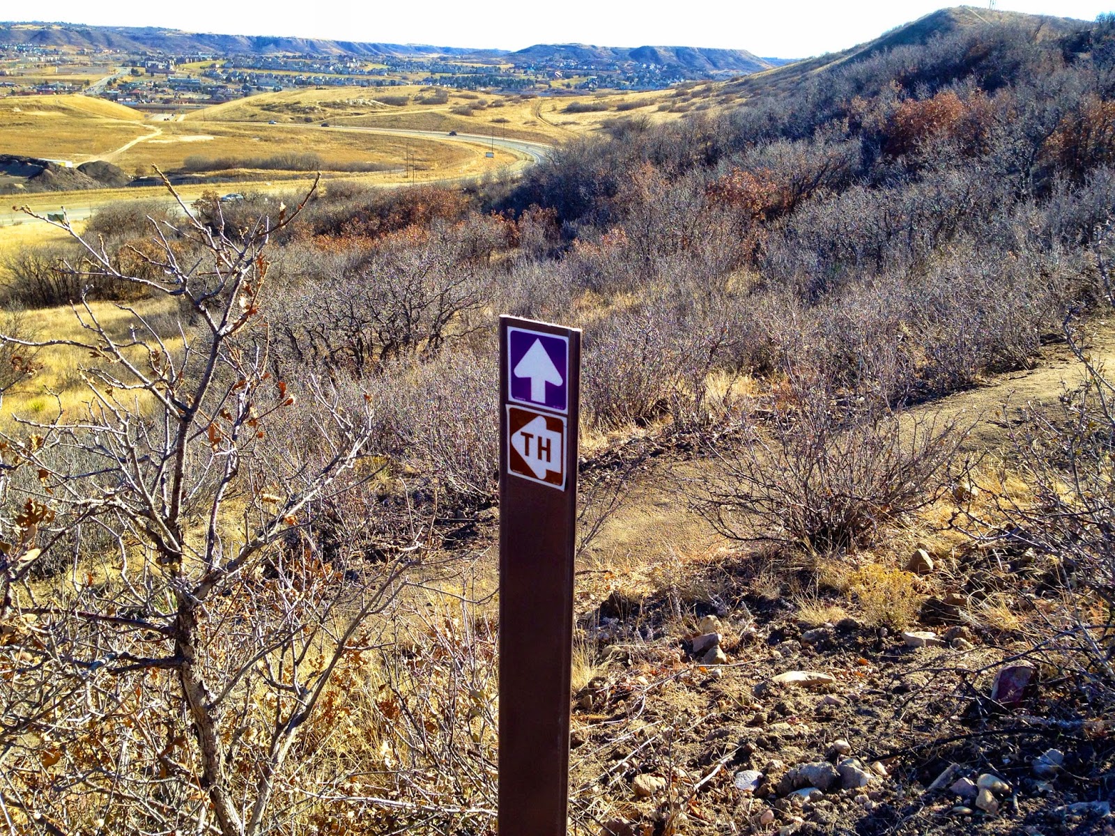
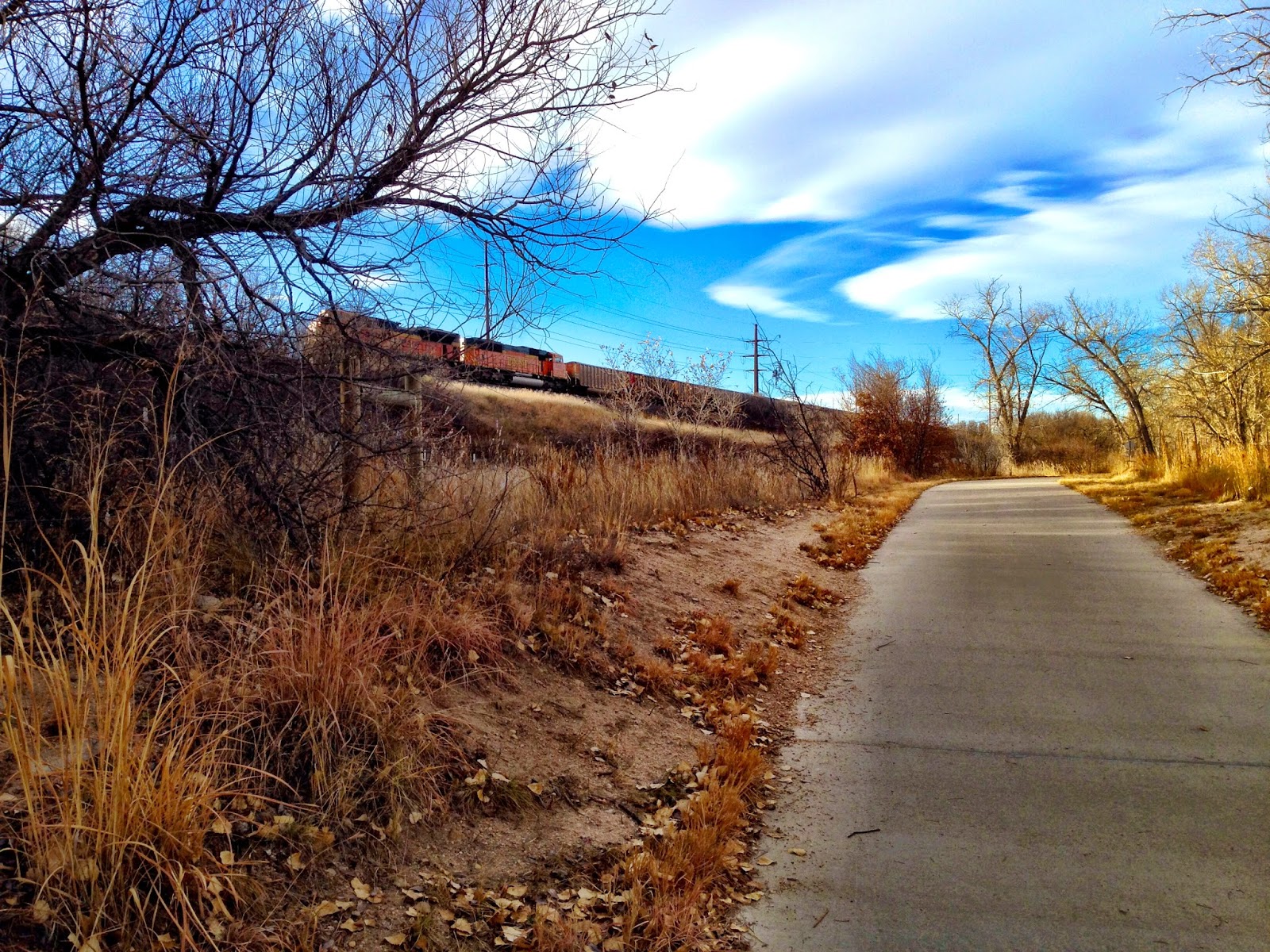
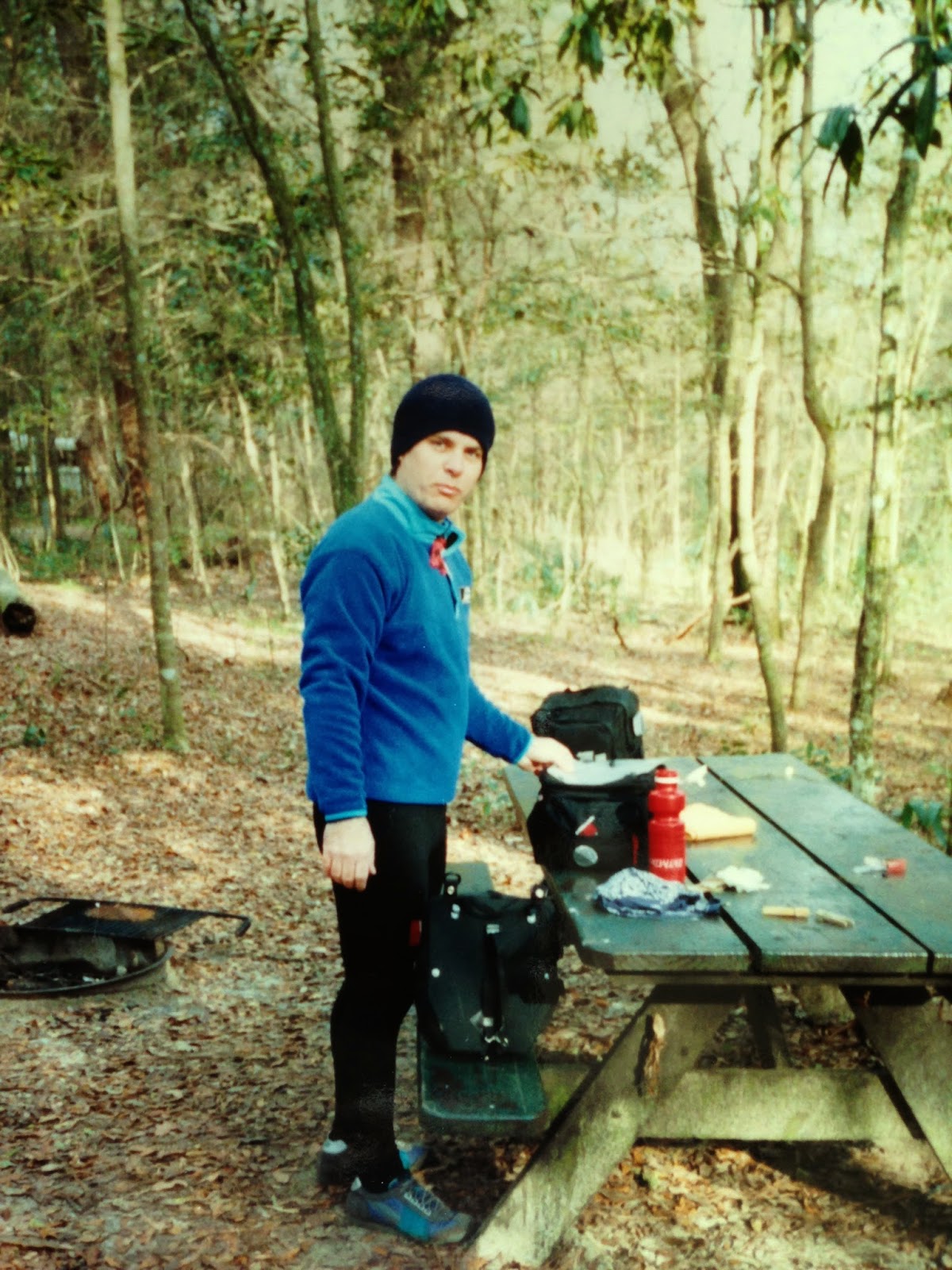
Bill Dion with north Georgia's War Woman Dell in the background
In the years I lived and worked in Chattanooga, TN, I discovered northern Georgia as my favorite destination for backpacking, canoeing, camping and bicycling.  The busy four-lane highways had not yet been built and the small towns and beautiful country was just waiting to be discovered.  It still retains a lot of that charm and I highly recommend you go see for yourself.  Check out the spring and fall festivals throughout the area.
A few years later my friend Bill Dion and I cooked up some bicycle tours of north Georgia and actually bicycle toured the area twice.  I still have some photos of those trips and nice memories.
Bill is a tall guy and bicycling behind him was awesome for me because he blocked any headwinds, making my ride much easier.  Life didn't work the same way when I rode in front, Bill could never get far enough out of the wind to have an easy ride.  We did get along well, though, and that makes for a good bicycle touring partnership.
Cheers!
Our routes started in Ellijay, GA and followed north to the town of Blue Ridge, then east across the mountains to Suches.  We would then drop down to camp at Vogel State Park and cross Richard Russell Scenic Highway and the AT before dropping downhill into Unicoi, making the big left turn toward Hiawassee.  Passing the road to Georgia's highest mountain, Brasstown Bald and back to Vogel again before the long downhill glide into Dahlonega.  We would stay at Amicolola Falls State Park and return to Ellijay.
The warm part of the ride
Except for that first time...  But I got ahead of my story.
While the routes changed a bit each time, we still followed highways 5 and 76 north from Ellijay to Blue Ridge before turning east toward Morgenton.  During our first trip they were building the four-lane highway which prompted several dead-end runs and lots of carrying the loaded bicycles across the mud to get back to the old road sections.  Our first trip we stayed at Two Wheels Only, a motorcycle campground at Suches who welcomed us in on our bicycles.  The food there was great that night and we slept awesomely, due to pedaling up and down mountain passes all day long.
We did camp at Vogel State Park twice and on the next trip used a walk-in campsite where the view from the tent platform was of halfway up the trees.
Richard Russell Scenic Highway is still beautifully scenic, but it was very steep and we had to use our lowest gears and stop lots to rest on the way up.  The weather was cold and cloudy with swirling clouds around us on the climb.  At our last stop before the top I remarked to Bill "You are on fire!", and from the clouds evaporating heat from us in the cold air, we both appeared to be on fire.  We took way too long a break at the top, and I put on my old yellow rain suit to keep warm during the descent.  Bill found that hilarious and called me "downhill man".
Downhill from here
At Unicoi we were welcome to camp but with packing light for bicycle touring, we didn't have the clothing required for dinner at the restaurant.  We rode in to Helen and bought some food, eating at the campsite, watching our clothes dry that night.
A highlight of the next day was the hill along Owl Creek Road.  The road is pleasant and very quiet until you reach the wall.  It went straight up about as steep as you can drive road paving gear down, for what seemed at the time like hours.  Maybe we had aged since the first tour, but the second time we rode Owl Creek Road we were astonished we had no recollection of the pain of the first trip's climb.
The drop off the mountains into Dahlonega the next day was just plain wonderful and we just missed the bad weather coming in.  A big thanks to the gentlemen who watched our bicycles for us while we viewed the historical film at the old courthouse.
Once again, we found ourselves climbing an amazingly steep hill into Amicalola State Park to get to the campsites.  That steep route has since been rebuilt to make it more safe and they have built an awesome lodge at the top, near the start of the Appalachian Trail.
Laundry at Unicoi
Here's where I left off with "that first time..."  In the morning, Bill's brakes gave out while going down the big hill on the last curve.  He crashed, taco-ing his front wheel and launching panniers and stuff everywhere.  I was behind Bill and got to witness everything.  Bill landed in the grass along the roadside and was mostly unhurt.  After finding his missing glasses lens, we walked his bicycle down the mountain to the welcome center.
I left my panniers there and got to pedal a most awesome bicycle ride into Ellijay that day by myself.  I was swooping past everything, riding fast and free, unencumbered by my loaded pannier weight.  It was an awesome experience I'll never forget.
I picked up my truck and drove back to get Bill.  We drove on south out of the mountains, making it to High Falls State Park where we slept for the night before getting home to central Florida the next day.

Friday, August 22, 2014

A short weekend-long bicycle tour of north Florida


Our loaded mountain bicycles at the corner of Where and Am I?
Walt Foy and I bicycled a back roads route through the farmland of northern Florida, riding a loop from Florida Caverns to Three Rivers State Park and back over a 2 day weekend.  The whole route can be driven in about 3-4 hours the same day and still leave time to tour the Caverns before you leave, but I suggest you try riding a bicycle instead.  Moving along at 10 MPH is the best way to really see the land and experience the topography.  You also feel a sense of "earning" it when you carry your camping gear along the route.  With the low amount of traffic and with only one hill, it was a pleasant ride.
We drove up on Friday, camping at Florida Caverns that night.  In the morning we pedaled out into the country and open farmland.  I remember it was cool weather, but not cold.  The clouds were few and bicycling on our mountain bikes was easy.  Walt didn't own a touring bike, so I left mine at home and we rode our mountain bikes instead.
In the afternoon, we reached the bottom of a large hill where we could see the campsites to the left in Three Rivers State Park.  However, we had to ride uphill to get to the entrance, then coast back downhill to pick a site by the lake.  The bathrooms were clean and the hot showers were welcome.
Waiting for the coffee to kick in the next morning
Walt was watching an osprey dive for dinner across the lake from our campsite when I returned from the shower.  The park was very peaceful and you could hear fish jumping in the lake.  After dinner a couple in a huge motor home bus parked next door to us invited us over to visit.  I think they were interested in us riding bicycles and camping in small tents that took less space than the closet did in their bus.  I know I slept well that night.
The next day was cool and overcast, and after barreling down the hill exiting the park, we rode along more back roads and beside farmland until we got back to Florida Caverns.  After a shower we enjoyed the excellent tour of the cave, delighted to be just a few feet underground in Florida.  I highly recommend the Florida Caverns tour with its interesting geology.

Friday, August 15, 2014

Bicycling Cohutta

Walt bicycling
Mountain Biking in the mountains of North Georgia is a hoot.  Walt and I camped in the Conasauga Recreation Area near the Cohutta Wilderness Area.  Normally we wouldn't ride mountain bikes in a wilderness area, but they were allowed in the Recreation Area, so we went.  It was near the end of the season, so there were few people there.
Me at a blaze
The campout was nice in the cool fall temperatures and after breakfast, we rode down some pretty steep trails, some with with jumps at the end for motorcycles.  We jumped too.  Stuff broke loose and had to be fixed.  Eventually we had to ride back uphill and that took the rest of the day.
Walt fixing something, banana-less
Before we turned around, Walt was looking for a banana for a snack that was in his rack trunk.  The banana skin was still there, but the banana had been pureed by the jumps into wetness.
Me cranking back uphill
We did have a great day riding and after a drive into town for dinner, we returned to the campsite that night for more peace and quiet.
To get there, go north 4 miles on US 441 from Chatsworth, GA into Eton.  Turn right onto Forest Service road 18 for 10 miles, then left onto Forest Service Road 68 for 10 miles.

Friday, August 8, 2014

Bicycling South Georgia


Starting at Seminole Lake
My friend Bill Dion and I rode a bicycle tour through southern Georgia.  We followed the Chattahoochee River north on back roads from Lake Seminole for two days, and returned the same route.  We drank gallons of water and discovered Jolly Rancher Peach candies along the way.
Our route took us through small farming towns like Blakely and Fort Gaines.  I remember passing many fallow fields, and others where the corporations had obviously taken over.
Bill along the road

This route was flat, real flat

Cool old 5 cent Coke sign

Break by a stream

The Chattahoochee River

I am hot and tired
We turned back south after camping at George T Bagby State Park.  While we had planned to see the canyons at Providence Canyon State Park, we ran out of time.  It was early fall and the temperatures were way too hot.  Bicycling in the heat was bad enough, but it never cooled down enough to sleep at night.  Add some technical problems and it was all we could really do just to pedal along in the heat. We did get to spend two nights at Kolomoki Mounds Historic Park, both coming and going.
The heat was just too much for both of us
At George T Bagby State Park with a broken spoke
Kolomoki Mounds in the largest and oldest Woodland Indian Mound site in the United States.  The 1294 acre site protects the 57 foot high Temple Mound, several smaller ceremonial and two burial mounds. The area was occupied from about 350 AD to 750 AD.  There is much to do at the park, including camping, boating and some hiking.  Check out the museum and store.
Me in front of the Temple Mound.  Classic touring tee.

...and Bill in front of the Temple Mound, Miami Vice and all

Stairway from Heaven

Camping at Kolomoki

Kolomoki Mounds

Large ceremonial fields
We passed many historic sites and old homes and businesses along the way.  Most were in good repair and were still in use.  I don't remember just where these were located, but they were along the route.


Our route was mapped by the Georgia Tourist Commission and is still a popular bicycle route today.  I would like to retrace this route in a car and enjoy the sights, camping along the way.